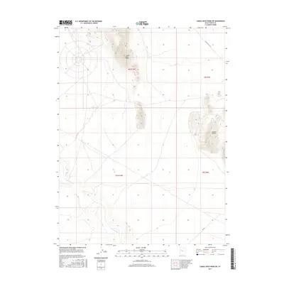
2017 Map of Camels Back Ridge SW
USGS Topo · Published 2017About this map
The Old River Bed snakes through this arid Tooele County basin, a distinct hydrographic remnant marking the desert floor. This 2017 survey by the U.S. Geological Survey details a landscape shaped by significant relief, notably the prominent spine of Camels Back Ridge and the cluster of Simpson Buttes to the east. These geological features dominate the central and eastern portions of the quadrangle, with the buttes rising sharply from the surrounding flats. Human traces are sparse across this expanse, primarily limited to unpaved routes like Simpson Buttes Rd and the numbered secondary road Tc02454. The map provides a clear picture of the vast open-country drainage patterns and topographical transitions between the high ridges and the ancient watercourse of the Great Basin.
Find a feature on this map
9 named features on this map. Tap any name to fly to it.
Don’t see what you’re looking for? This feature index may not catch every label — zoom into the map to look around manually.
Map Details
Editions of this 2017 Camels Back Ridge SW Map
This is the sole edition of this map. No revisions or reprints were ever made.
Other maps of this area

1885 · Sevier Desert
USGS Topo · 1:250,000

1885 · Tooele Valley
USGS Topo · 1:250,000

1908 · Fish Springs
USGS Topo · 1:250,000

1910 · Fish Springs
USGS Topo · 1:250,000

1953 · Dugway Range NE
USGS Topo · 1:24,000

1953 · Dugway Range
USGS Topo · 1:62,500

1953 · Tooele
USGS Topo · 1:250,000

1953 · Delta
USGS Topo · 1:250,000

1954 · Dugway Proving Ground SE
USGS Topo · 1:24,000

1954 · Dugway Proving Ground NE
USGS Topo · 1:24,000