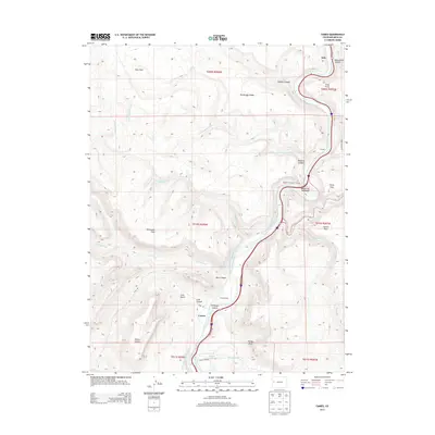
2013 Map of Cameo
USGS Topo · Published 2013About this map
De Beque Canyon serves as the dramatic centerpiece of this Mesa County landscape, where the Colorado River carves through the high desert. The small settlement of Cameo sits alongside the riverbank, supported by a network of transportation and water infrastructure including the Cameo Siding and the Government Highline Canal. This engineering is further evidenced by the Beavertail Mountain Tunnel and the nearby Tunnel through the canyon walls, facilitating passage along this narrow corridor.
Find a feature on this map
41 named features on this map. Tap any name to fly to it.
Don’t see what you’re looking for? This feature index may not catch every label — zoom into the map to look around manually.
Map Details
Editions of this 2013 Cameo Map
This is the sole edition of this map. No revisions or reprints were ever made.
Other maps of this area

1929 · Grand Valley
USGS Topo · 1:62,500

1929 · Roan Creek
USGS Topo · 1:62,500

1955 · Cameo
USGS Topo · 1:24,000

1955 · Mesa
USGS Topo · 1:24,000

1956 · Grand Junction
USGS Topo · 1:250,000

1959 · Grand Junction
USGS Topo · 1:250,000

1960 · Grand Junction
USGS Topo · 1:250,000

1962 · Grand Junction
USGS Topo · 1:250,000

1962 · Clifton
USGS Topo · 1:24,000
1962 · De Beque
USGS Topo · 1:24,000