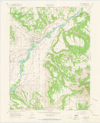
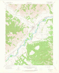
1962 Map of De Beque
USGS Topo · Published 1964About this map
The Colorado River carves a critical path through this Western Slope landscape, where the settlement of De Beque serves as a focal point for the region's ranching and transit history. In the early 1960s, the town was already a established hub for the Denver and Rio Grande Western railroad, which parallels the river's course. The surrounding geography is defined by a complex network of water management and natural drainages, from the Bluestone Valley and Ditch No 2 to smaller catchments like Piute Reservoir and Sunnyside Reservoir. To the east, the terrain rises sharply toward the White River National Forest, anchored by Horsethief Mountain. This survey captures a moment of mid-century infrastructure, highlighting the importance of routes like the De Beque Cutoff Road and local landmarks like Mount Low in a region where water and rail dictated the shape of development.
Find a feature on this map
24 named features on this map. Tap any name to fly to it.
Don’t see what you’re looking for? This feature index may not catch every label — zoom into the map to look around manually.
Map Details
Editions of this 1962 De Beque Map
4 editions found
Other maps of this area

1929 · Grand Valley
USGS Topo · 1:62,500

1929 · Roan Creek
USGS Topo · 1:62,500

1955 · Cameo
USGS Topo · 1:24,000

1955 · Mesa
USGS Topo · 1:24,000

1955 · Molina
USGS Topo · 1:24,000

1956 · Grand Junction
USGS Topo · 1:250,000

1959 · Grand Junction
USGS Topo · 1:250,000

1960 · Grand Junction
USGS Topo · 1:250,000

1962 · Grand Junction
USGS Topo · 1:250,000
1962 · Grand Valley
USGS Topo · 1:24,000