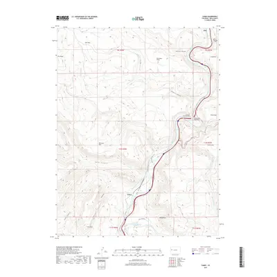
2019 Map of Cameo
USGS Topo · Published 2019About this map
The Colorado River carves a deep path through De Beque Canyon in this western Colorado landscape, where the settlement of Cameo serves as a focal point for infrastructure and industry. The terrain is defined by sharp elevation changes, from the heights of Mt Lincoln and Beavertail Mountain down to the flats of Whittaker Flats and Silvey Flats. Evidence of regional water management is prominent, notably the Government Highline Canal and the Palisade Reservoir Number 1, which supported local development and agriculture in an otherwise arid environment.
Find a feature on this map
43 named features on this map. Tap any name to fly to it.
Don’t see what you’re looking for? This feature index may not catch every label — zoom into the map to look around manually.
Map Details
Editions of this 2019 Cameo Map
This is the sole edition of this map. No revisions or reprints were ever made.
Other maps of this area

1929 · Grand Valley
USGS Topo · 1:62,500

1929 · Roan Creek
USGS Topo · 1:62,500

1955 · Cameo
USGS Topo · 1:24,000

1955 · Mesa
USGS Topo · 1:24,000

1956 · Grand Junction
USGS Topo · 1:250,000

1959 · Grand Junction
USGS Topo · 1:250,000

1960 · Grand Junction
USGS Topo · 1:250,000

1962 · Grand Junction
USGS Topo · 1:250,000

1962 · Clifton
USGS Topo · 1:24,000
1962 · De Beque
USGS Topo · 1:24,000