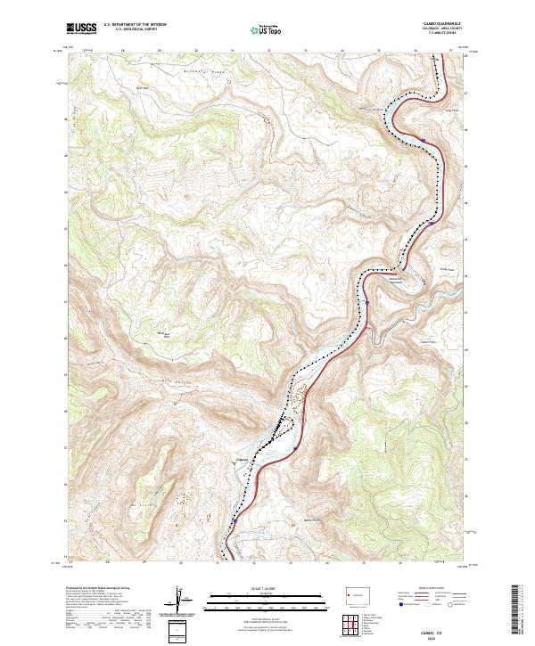
2022 Map of Cameo
USGS Topo · Published 2022About this map
Colorado River navigation and industrial resource management define this landscape in Mesa County, where the river carves through the dramatic walls of De Beque Canyon. The settlement of Cameo is situated along the riverbanks, served by the Government Highline Canal, which snakes through the valley to support regional water needs. The surrounding terrain is a complex system of deep drainages and high plateaus, including Main Canyon, Coal Canyon, and Coal Gulch, which speak to the area's geological and extractive history. High points like Mt Lincoln and Beavertail Mountain provide significant landmarks above the canyon floor. The map also documents a network of high-desert flats such as Whittaker Flats and Cobert Flats, connected by rugged paths like the Spring Creek Trl and Cobblestone Trl.
Find a feature on this map
43 named features on this map. Tap any name to fly to it.
Don’t see what you’re looking for? This feature index may not catch every label — zoom into the map to look around manually.
Map Details
Editions of this 2022 Cameo Map
This is the sole edition of this map. No revisions or reprints were ever made.
Other maps of this area

1929 · Grand Valley
USGS Topo · 1:62,500

1929 · Roan Creek
USGS Topo · 1:62,500

1955 · Cameo
USGS Topo · 1:24,000

1955 · Mesa
USGS Topo · 1:24,000

1956 · Grand Junction
USGS Topo · 1:250,000

1959 · Grand Junction
USGS Topo · 1:250,000

1960 · Grand Junction
USGS Topo · 1:250,000

1962 · Grand Junction
USGS Topo · 1:250,000

1962 · Clifton
USGS Topo · 1:24,000
1962 · De Beque
USGS Topo · 1:24,000