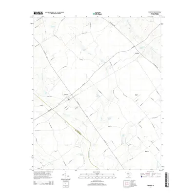
2014 Map of Cameron
USGS Topo · Published 2014About this map
Cameron serves as a central hub in this landscape where the Calhoun Co and Orangeburg Co boundary line intersects a mosaic of agricultural fields and extensive wetlands. The region is defined by significant swamp systems, including Four Hole Swamp and Goodbys Swamp, which dominate the low-lying drainage patterns alongside Halfway Swamp Cr. Smaller settlements such as Creston and Midway are connected by a network of established routes like Old State Rd and Old Number Six Hwy, indicating long-standing transportation corridors through the South Carolina interior.
Find a feature on this map
71 named features on this map. Tap any name to fly to it.
Don’t see what you’re looking for? This feature index may not catch every label — zoom into the map to look around manually.
Map Details
Editions of this 2014 Cameron Map
This is the sole edition of this map. No revisions or reprints were ever made.
Other maps of this area

1920 · Bowman
USGS Topo · 1:48,000

1920 · Orangeburg
USGS Topo · 1:48,000

1921 · Orangeburg
USGS Topo · 1:62,500

1921 · Bowman
USGS Topo · 1:62,500

1943 · Bowman
USGS Topo · 1:62,500

1943 · Orangeburg
USGS Topo · 1:125,000

1943 · Orangeburg
USGS Topo · 1:62,500

1946 · Elloree
USGS Topo · 1:62,500

1946 · St. Matthews
USGS Topo · 1:62,500

1954 · Augusta
USGS Topo · 1:250,000