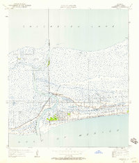
1934 Map of Cameron
USGS Topo · Published 1958About this map
Cameron sits at the critical junction where the freshwater systems of Calcasieu Lake meet the saltwater of the Gulf of Mexico. Surveyed in the mid-1930s, this landscape is defined by the shifting navigation of Calcasieu Pass, protected at its mouth by the Jetty and illuminated for mariners by the Calcasieu Light. The map reveals the intricate network of marsh and waterway, including the convergence of the West Fork and East Fork around St Johns Island. Local life is anchored by higher ground like Back Ridge and the presence of the Rose Sch and State Highway 42. The transition from the sprawling Mud Flat to the settled grid of Cameron reflects the era's reliance on these coastal waterways for both travel and trade before significant modern development altered the shoreline.
Find a feature on this map
16 named features on this map. Tap any name to fly to it.
Don’t see what you’re looking for? This feature index may not catch every label — zoom into the map to look around manually.
Map Details
Editions of this 1934 Cameron Map
3 editions found
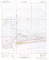
Other maps of this area

1934 · Cameron
USGS Topo · 1:24,000

1934 · Holly Beach
USGS Topo · 1:24,000

1934 · Sweet Lake
USGS Topo · 1:24,000

1934 · Browns Lake
USGS Topo · 1:24,000

1934 · Grand Bayou
USGS Topo · 1:24,000

1935 · Cameron
USGS Topo · 1:31,680

1935 · Sweet Lake
USGS Topo · 1:31,680

1935 · Hackberry
USGS Topo · 1:31,680

1935 · Holly Beach
USGS Topo · 1:31,680

1935 · Grand Bayou
USGS Topo · 1:31,680