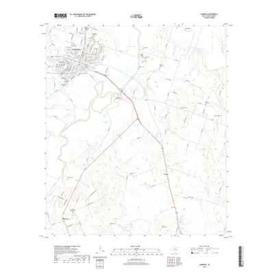
2019 Map of Cameron
USGS Topo · Published 2019About this map
Cameron serves as the central hub of this Milam County landscape, situated where the Little River bends through the northern terrain. The town's grid is dense with residential streets like W 24th St and E Main St, supported by local infrastructure including the Cameron Municipal Airpark. Outside the town center, the map reveals a rural expanse defined by water bodies such as Green Lake and Newton Lake, and numerous small family and community burial grounds that speak to the area's deep genealogical roots. Settlements like Minerva and Hoyte anchor the south and southeast, connected by a network of rural routes. The distribution of sites like the Culpepper Family Cem and Griffin Chapel Cem indicates a pattern of established homesteads and small church communities scattered across the plains and creek bottoms near Sandy Cr and Mustang Cr.
Find a feature on this map
125 named features on this map. Tap any name to fly to it.
Don’t see what you’re looking for? This feature index may not catch every label — zoom into the map to look around manually.
Map Details
Editions of this 2019 Cameron Map
This is the sole edition of this map. No revisions or reprints were ever made.
Other maps of this area

1885 · Taylor
USGS Topo · 1:125,000

1887 · Taylor
USGS Topo · 1:125,000

1894 · Taylor
USGS Topo · 1:125,000

1954 · Austin
USGS Topo · 1:250,000

1956 · Milano
USGS Topo · 1:62,500

1961 · Hanover
USGS Topo · 1:24,000

1961 · Cameron
USGS Topo · 1:24,000

1961 · Rockdale East
USGS Topo · 1:24,000

1962 · Rockdale West
USGS Topo · 1:24,000
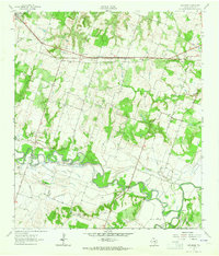
1962 · Pettibone
USGS Topo · 1:24,000