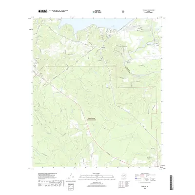
2019 Map of Camilla
USGS Topo · Published 2019About this map
Sam Houston National Forest covers much of this landscape, where the southern reaches of Lake Livingston meet the winding Trinity River. The map documents a rural network of family and community history, evidenced by numerous burial grounds such as Cochran Cem, Rose Hill Cem, and Mitchell Cem. At the northern edge, the Lake Livingston Dam Rd marks the major engineering that shaped the modern hydrology of the region, creating water bodies like Blue Lake and Stock Pen Lake near the Polk and San Jacinto County line.
Find a feature on this map
103 named features on this map. Tap any name to fly to it.
Don’t see what you’re looking for? This feature index may not catch every label — zoom into the map to look around manually.
Map Details
Editions of this 2019 Camilla Map
This is the sole edition of this map. No revisions or reprints were ever made.
Other maps of this area

1943 · Liberty
USGS Topo · 1:125,000

1954 · Beaumont
USGS Topo · 1:250,000

1955 · Rayburn
USGS Topo · 1:62,500

1957 · Beaumont
USGS Topo · 1:250,000

1958 · Westcott
USGS Topo · 1:24,000

1958 · Livingston
USGS Topo · 1:62,500

1958 · Bear Creek
USGS Topo · 1:24,000

1960 · Blanchard
USGS Topo · 1:24,000

1960 · Stephen Creek
USGS Topo · 1:24,000

1960 · Camilla
USGS Topo · 1:24,000