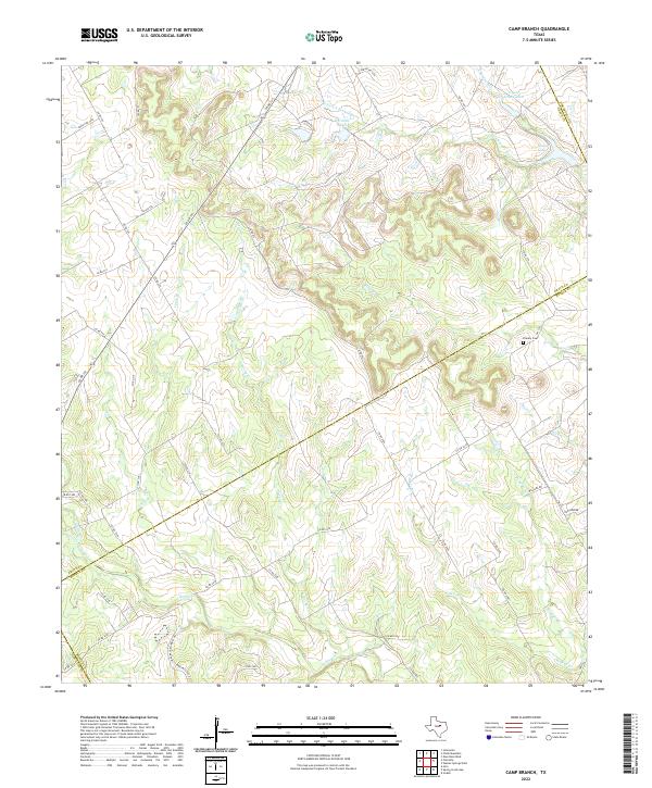
2022 Map of Camp Branch
USGS Topo · Published 2022About this map
The W Fork E Bosque River and its numerous tributaries carve a complex drainage pattern across this rural landscape where Erath, Bosque, Somervell, and Hamilton counties meet. The interior is characterized by significant topographic relief, with deep-cut creek beds such as Duffau Cr and Rocky Cr winding through the terrain. Evidence of local family history and early settlement is preserved at the Flanary Cem, located near the Bosque County line. While the region remains largely undeveloped and agricultural, several private water bodies like El Colina Lake, Upper House Lake, and House Lake are prominent features in the northeast. The map documents an intricate network of county and parish roads, including Co RD 199 and Parish RD 1262, which follow the natural contours of the ridges and valleys.
Find a feature on this map
48 named features on this map. Tap any name to fly to it.
Don’t see what you’re looking for? This feature index may not catch every label — zoom into the map to look around manually.
Map Details
Editions of this 2022 Camp Branch Map
This is the sole edition of this map. No revisions or reprints were ever made.
Other maps of this area

1888 · Hamilton
USGS Topo · 1:125,000

1888 · Meridian
USGS Topo · 1:125,000

1889 · Granbury
USGS Topo · 1:125,000

1890 · Stephenville
USGS Topo · 1:125,000

1894 · Hamilton
USGS Topo · 1:125,000

1894 · Meridian
USGS Topo · 1:125,000

1920 · Stephenville
USGS Topo · 1:125,000

1954 · Brownwood
USGS Topo · 1:250,000

1954 · Dallas
USGS Topo · 1:250,000

1954 · Waco
USGS Topo · 1:250,000