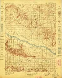
1898 Map of Camp Clarke
USGS Topo · Published 1898About this map
The North Platte River corridors of western Nebraska are captured here during a pivotal era of agricultural transformation. Just before the turn of the century, an intricate system of irrigation was being carved into the landscape, visible in the detailed paths of the Bayard Canal, Alliance Canal, and Chimney Rock Canal. These waterways were vital for the burgeoning settlements of Bayard and Camp Clarke, which served as critical hubs along the river’s north bank. South of the river, the iconic formations of the Wild West stand out, including the world-famous Chimney Rock and the massive profiles of Courthouse Rock and Jail Rock. The map reveals a land transitioning from open range to a settled agricultural economy, with remote post offices like Freeport and Redington dotting the valley of Pumpkin Creek amidst high bluffs and canyons like Logan Canyon and McManigal Canyon.
Find a feature on this map
63 named features on this map. Tap any name to fly to it.
Don’t see what you’re looking for? This feature index may not catch every label — zoom into the map to look around manually.
Map Details
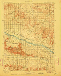
Editions of this 1898 Camp Clarke Map
5 editions found
Other maps of this area

1896 · Browns Creek
USGS Topo · 1:125,000

1898 · Scotts Bluff
USGS Topo · 1:125,000

1898 · Camp Clarke
USGS Topo · 1:125,000

1899 · Browns Creek
USGS Topo · 1:125,000

1899 · Sidney
USGS Topo · 1:125,000

1899 · Whistle Creek
USGS Topo · 1:125,000

1947 · Bronco Lake
USGS Topo · 1:24,000

1948 · Hemingford 4 SW
USGS Topo · 1:24,000

1948 · Hemingford 4 SE
USGS Topo · 1:24,000

1949 · Lynn
USGS Topo · 1:62,500