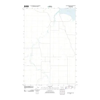
2011 Map of Camp Creek East
USGS Topo · Published 2011About this map
Audubon Lake occupies the northeastern corner of this 2011 survey, marking the primary water feature in a landscape dominated by the winding paths of Timber Creek and its tributary, Camp Creek. The terrain is defined by the drainage patterns of these creeks as they carve through the high plains of McKenzie County. Transportation across this rural expanse is anchored by a grid of section-line roads, including County Rd-16 and County Rd-28, which serve the local agricultural and ranching operations. The mapping reflects the contemporary configuration of the shoreline and the precise road network of the early 21st century, providing a baseline for understanding land use and hydrology in this portion of western North Dakota.
Find a feature on this map
5 named features on this map. Tap any name to fly to it.
Don’t see what you’re looking for? This feature index may not catch every label — zoom into the map to look around manually.
Map Details
Editions of this 2011 Camp Creek East Map
This is the sole edition of this map. No revisions or reprints were ever made.
Other maps of this area

1911 · Ray
USGS Topo · 1:125,000

1953 · Williston
USGS Topo · 1:250,000

1953 · Watford City
USGS Topo · 1:250,000

1957 · Williston
USGS Topo · 1:250,000

1957 · Watford City
USGS Topo · 1:250,000

1967 · Watford City
USGS Topo · 1:250,000

1972 · Alexander
USGS Topo · 1:24,000

1972 · Rawson
USGS Topo · 1:24,000

1978 · Lake Jessie
USGS Topo · 1:24,000

1978 · Watford City NW
USGS Topo · 1:24,000