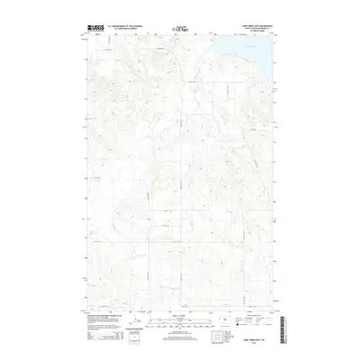
2014 Map of Camp Creek East
USGS Topo · Published 2014About this map
Lake Sakakawea defines the northern reaches of this Missouri River plateau landscape in McKenzie County. The topography is dominated by the intricate drainage systems of Timber Creek and Camp Creek, which carve deep, winding paths toward the reservoir. The upland areas are gridded by a network of rural roads such as 141st Ave NW and 34th St NW, reflecting the late-twentieth-century section-line development characteristic of North Dakota's ranching and agricultural lands. This survey documents the intersection of modern infrastructure with the natural riparian corridors that have shaped the region since before the inundation of the river valley.
Find a feature on this map
16 named features on this map. Tap any name to fly to it.
Don’t see what you’re looking for? This feature index may not catch every label — zoom into the map to look around manually.
Map Details
Editions of this 2014 Camp Creek East Map
This is the sole edition of this map. No revisions or reprints were ever made.
Other maps of this area

1911 · Ray
USGS Topo · 1:125,000

1953 · Williston
USGS Topo · 1:250,000

1953 · Watford City
USGS Topo · 1:250,000

1957 · Williston
USGS Topo · 1:250,000

1957 · Watford City
USGS Topo · 1:250,000

1967 · Watford City
USGS Topo · 1:250,000

1972 · Alexander
USGS Topo · 1:24,000

1972 · Rawson
USGS Topo · 1:24,000

1978 · Lake Jessie
USGS Topo · 1:24,000

1978 · Watford City NW
USGS Topo · 1:24,000