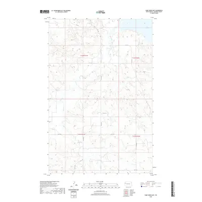
2020 Map of Camp Creek East
USGS Topo · Published 2020About this map
Lake Sakakawea dominates the northern horizon of this McKenzie County landscape, where the Missouri River valley was transformed by mid-century damming. The terrain is defined by the complex drainage systems of Timber Creek and Camp Creek, which carve deep coulees through the high plains. This 2020 edition reveals the intersection of modern rural infrastructure and historical land divisions, tracing the grid of section lines and gravel paths such as Co RD 29 and 139th St NW. The map illustrates the stark geography of the Williston Basin, documenting the remote reaches of North Dakota where the prairie plateau breaks toward the expansive reservoir shoreline. Researchers can follow the winding path of Timber Creek as it flows northward toward the lake, marking the natural contours of this sparsely settled ranching and energy-producing region.
Find a feature on this map
17 named features on this map. Tap any name to fly to it.
Don’t see what you’re looking for? This feature index may not catch every label — zoom into the map to look around manually.
Map Details
Editions of this 2020 Camp Creek East Map
This is the sole edition of this map. No revisions or reprints were ever made.
Other maps of this area

1911 · Ray
USGS Topo · 1:125,000

1953 · Williston
USGS Topo · 1:250,000

1953 · Watford City
USGS Topo · 1:250,000

1957 · Williston
USGS Topo · 1:250,000

1957 · Watford City
USGS Topo · 1:250,000

1967 · Watford City
USGS Topo · 1:250,000

1972 · Alexander
USGS Topo · 1:24,000

1972 · Rawson
USGS Topo · 1:24,000

1978 · Lake Jessie
USGS Topo · 1:24,000

1978 · Watford City NW
USGS Topo · 1:24,000