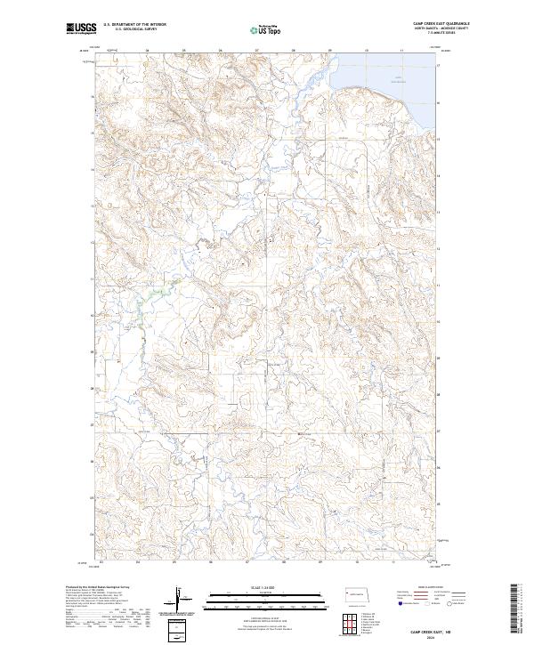
2024 Map of Camp Creek East
USGS Topo · Published 2024About this map
Lake Sakakawea defines the northeastern corner of this landscape in McKenzie County, where the reservoir waters meet the dissected breaks of the Missouri River valley. The terrain is characterized by a dense network of coulees and drainages, most notably Timber Creek, which winds northward through the center of the sheet toward the lake. The sectional land system is clearly visible, with gravel and section-line roads like Co Rd 29 and 39th St NW providing the primary access through these upland grazing lands. While largely devoid of named settlements, the map documents the rural infrastructure of the high plains, including the precise alignment of range roads such as 140th Ave NW and 137th Ave NW as they navigate the complex topography of the Williston Basin.
Find a feature on this map
16 named features on this map. Tap any name to fly to it.
Don’t see what you’re looking for? This feature index may not catch every label — zoom into the map to look around manually.
Map Details
Editions of this 2024 Camp Creek East Map
This is the sole edition of this map. No revisions or reprints were ever made.
Other maps of this area

1911 · Ray
USGS Topo · 1:125,000

1953 · Williston
USGS Topo · 1:250,000

1953 · Watford City
USGS Topo · 1:250,000

1957 · Williston
USGS Topo · 1:250,000

1957 · Watford City
USGS Topo · 1:250,000

1967 · Watford City
USGS Topo · 1:250,000

1972 · Alexander
USGS Topo · 1:24,000

1972 · Rawson
USGS Topo · 1:24,000

1978 · Lake Jessie
USGS Topo · 1:24,000

1978 · Watford City NW
USGS Topo · 1:24,000