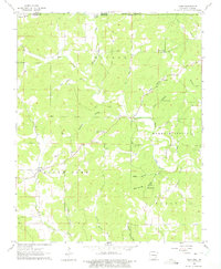
1962 Map of Camp
USGS Topo · Published 1975About this map
Myatt Creek and its many tributaries, such as Elm Spring Branch and Dye Branch, define the topography along the Missouri and Arkansas border in the early 1960s. This rural landscape is dotted with several small community centers and family burial grounds, including the Fryatt Cem and Kerby Cem. Small religious institutions such as Pleasant Ridge Ch and Faith Tabernacle suggest a decentralized settlement pattern focused around the creek valleys. Near the community of Camp, the terrain is marked by numerous hollows like Thornton Hollow and Glass Hollow, which reflect the area's complex drainage network. A single Quarry provides evidence of local resource extraction, while the surrounding area remains primarily agricultural or forested as it appeared during this mid-century survey.
Find a feature on this map
43 named features on this map. Tap any name to fly to it.
Don’t see what you’re looking for? This feature index may not catch every label — zoom into the map to look around manually.
Map Details
Editions of this 1962 Camp Map
2 editions found
Other maps of this area

1943 · Thayer
USGS Topo · 1:62,500

1944 · West Plains
USGS Topo · 1:62,500

1946 · Thayer
USGS Topo · 1:62,500

1946 · West Plains
USGS Topo · 1:62,500

1950 · Salem
USGS Topo · 1:62,500

1951 · Salem
USGS Topo · 1:62,500

1957 · Poplar Bluff
USGS Topo · 1:250,000

1959 · Poplar Bluff
USGS Topo · 1:250,000

1960 · Poplar Bluff
USGS Topo · 1:250,000

1962 · Stuart
USGS Topo · 1:24,000