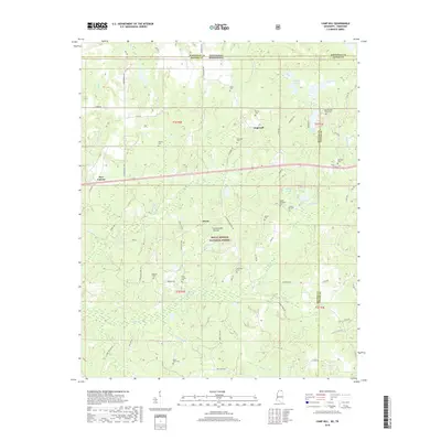
2018 Map of Camp Hill
USGS Topo · Published 2018About this map
The Wolf River meanders through this section of northern Mississippi, defining the drainage patterns for a landscape dotted with small family settlements and numerous burial grounds. Centered on the Holly Springs National Forest, the area transitions from the wooded slopes of the Cumberland Plateau to the fertile bottomlands near Brody and New Canaan. Genealogists will find a wealth of local history in the high density of small cemeteries, including Black Jack Cem, Medlock Cem, and Hines Cem, which are often situated near old parish roads and church sites like Zion Chapel Cem. The map illustrates a rural economy tied to the land and the water, with named tributaries such as Sourwood Cr and Moody Cr feeding into the river system. Northward, the landscape reaches toward the Tennessee state line, where the rural crossroads of Hopewell sits near the headwaters of E Fork Spring Cr.
Find a feature on this map
84 named features on this map. Tap any name to fly to it.
Don’t see what you’re looking for? This feature index may not catch every label — zoom into the map to look around manually.
Map Details
Editions of this 2018 Camp Hill Map
This is the sole edition of this map. No revisions or reprints were ever made.
Other maps of this area

1950 · Ashland
USGS Topo · 1:62,500

1950 · Middleton
USGS Topo · 1:24,000

1950 · Grand Junction
USGS Topo · 1:24,000

1951 · Middleton
USGS Topo · 1:24,000

1951 · Grand Junction
USGS Topo · 1:24,000

1951 · Walnut
USGS Topo · 1:62,500

1952 · Saulsbury
USGS Topo · 1:24,000

1956 · Blytheville
USGS Topo · 1:250,000

1956 · Tupelo
USGS Topo · 1:250,000

1958 · Tupelo
USGS Topo · 1:250,000