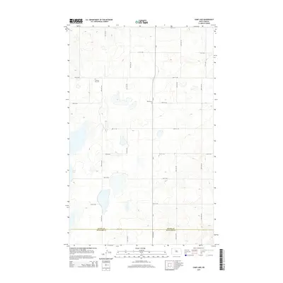
2014 Map of Camp Lake
USGS Topo · Published 2014About this map
The rolling prairies along the Divide Co Williams Co boundary are defined by a grid of rural section lines and glacial depressions. This 2014 survey captures a quiet agricultural landscape where Camp Lake sits as the primary water body in the western portion of the quadrangle. Local history and genealogy are anchored by two distinct burial sites: W Writing Rock Cem in the northwest and Bethel Cem located near the center of the sheet along Cr-5. The infrastructure is almost exclusively composed of numbered roads like 92nd St NW and 152nd Ave NW, which trace the path of earlier homestead-era boundaries. This map provides a clear record of the sparsely populated but meticulously organized land on the outskirts of Grenora.
Find a feature on this map
20 named features on this map. Tap any name to fly to it.
Don’t see what you’re looking for? This feature index may not catch every label — zoom into the map to look around manually.
Map Details
Editions of this 2014 Camp Lake Map
This is the sole edition of this map. No revisions or reprints were ever made.
Other maps of this area

1946 · Brush Lake
USGS Topo · 1:24,000

1948 · Grenora
USGS Topo · 1:24,000

1948 · Hanks
USGS Topo · 1:24,000

1948 · Brush Lake
USGS Topo · 1:24,000

1953 · Williston
USGS Topo · 1:250,000

1954 · Wolf Point
USGS Topo · 1:250,000

1957 · Williston
USGS Topo · 1:250,000

1958 · Wolf Point
USGS Topo · 1:250,000

1983 · Westby South
USGS Topo · 1:24,000

1983 · Writing Rock North
USGS Topo · 1:24,000