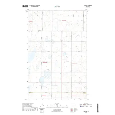
2017 Map of Camp Lake
USGS Topo · Published 2017About this map
Camp Lake and a landscape dotted with ephemeral wetlands define this section of the northwestern North Dakota prairie near the turn of the 21st century. The map centers on the border between Divide Co and Williams Co, revealing a grid-iron network of section-line roads such as 87th St NW and 151st Ave NW. This survey preserves the locations of vital community landmarks in a sparsely populated region, specifically the West Writing Rock Cem and Bethel Cem, which serve as quiet markers of the area's early homesteading history.
Find a feature on this map
30 named features on this map. Tap any name to fly to it.
Don’t see what you’re looking for? This feature index may not catch every label — zoom into the map to look around manually.
Map Details
Editions of this 2017 Camp Lake Map
This is the sole edition of this map. No revisions or reprints were ever made.
Other maps of this area

1946 · Brush Lake
USGS Topo · 1:24,000

1948 · Grenora
USGS Topo · 1:24,000

1948 · Hanks
USGS Topo · 1:24,000

1948 · Brush Lake
USGS Topo · 1:24,000

1953 · Williston
USGS Topo · 1:250,000

1954 · Wolf Point
USGS Topo · 1:250,000

1957 · Williston
USGS Topo · 1:250,000

1958 · Wolf Point
USGS Topo · 1:250,000

1983 · Westby South
USGS Topo · 1:24,000

1983 · Writing Rock North
USGS Topo · 1:24,000