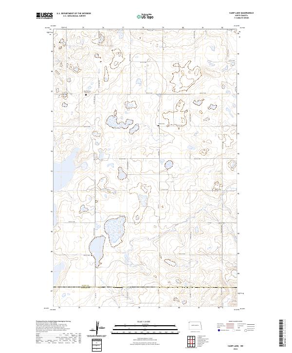
2024 Map of Camp Lake
USGS Topo · Published 2024About this map
The Divide County Waterfowl Production Area dominates this landscape on the high plains of the North Dakota-Montana border. This modern survey illustrates a topography of glacial prairie potholes, with numerous small, unnamed water bodies and wetlands scattered across the sectional grid. The map captures the boundary between Divide County and Williams County at 84th St NW, showing a land primarily dedicated to conservation and agriculture. Local history is anchored by the presence of West Writing Rock Cem and Bethel Cem, which sit alongside a network of rural routes such as Co Hwy 5 and Co Hwy 7. The arrangement of these cemeteries and the preservation of the waterfowl areas reflect the enduring rural character and specialized land use of the Northwestern North Dakota region.
Find a feature on this map
30 named features on this map. Tap any name to fly to it.
Don’t see what you’re looking for? This feature index may not catch every label — zoom into the map to look around manually.
Map Details
Editions of this 2024 Camp Lake Map
This is the sole edition of this map. No revisions or reprints were ever made.
Other maps of this area

1946 · Brush Lake
USGS Topo · 1:24,000

1948 · Grenora
USGS Topo · 1:24,000

1948 · Hanks
USGS Topo · 1:24,000

1948 · Brush Lake
USGS Topo · 1:24,000

1953 · Williston
USGS Topo · 1:250,000

1954 · Wolf Point
USGS Topo · 1:250,000

1957 · Williston
USGS Topo · 1:250,000

1958 · Wolf Point
USGS Topo · 1:250,000

1983 · Westby South
USGS Topo · 1:24,000

1983 · Writing Rock North
USGS Topo · 1:24,000