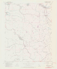
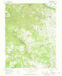
1954 Map of Camp Meeker
USGS Topo · Published 1973About this map
Bohemian Grove and the winding Russian River anchor this mid-century survey of western Sonoma County. The landscape reflects a mix of resort communities, religious retreats, and small agricultural hubs. Notable retreats like Westminister Woods, Alliance Redwood, and a Boy Scout Camp near Occidental illustrate the area's long-standing role as a recreational escape. The river corridor is dotted with named clusters such as Guerneville, Noel Heights, and Summerhome, while the southern reaches transition into the hills of Bodega and Estero Americano.
Find a feature on this map
53 named features on this map. Tap any name to fly to it.
Don’t see what you’re looking for? This feature index may not catch every label — zoom into the map to look around manually.
Map Details
Editions of this 1954 Camp Meeker Map
5 editions found
Other maps of this area

1920 · Healdsburg
USGS Topo · 1:62,500

1921 · Skaggs
USGS Topo · 1:62,500

1933 · Healdsburg
USGS Topo · 1:48,000

1935 · Sebastopol
USGS Topo · 1:48,000

1940 · Healdsburg
USGS Topo · 1:62,500

1942 · Sebastopol
USGS Topo · 1:62,500

1942 · Bodega Head
USGS Topo · 1:24,000

1943 · Cazadero
USGS Topo · 1:24,000

1943 · Duncans Mills
USGS Topo · 1:24,000

1944 · Bodega Head
USGS Topo · 1:31,680