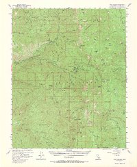
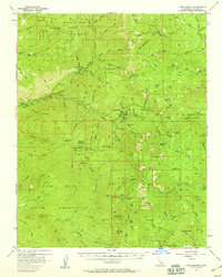
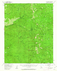
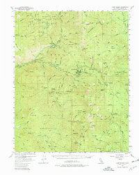
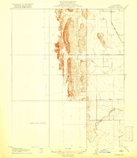
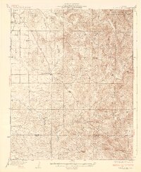
1956 Map of Camp Nelson
USGS Topo · Published 1967About this map
Mountain Home (Grove) State Forest and the vast Sequoia National Forest dominate this mid-century landscape in the southern Sierra Nevada. The topography is defined by the deep canyons of the Middle Fork Tule River and the South Fork Tule River, which drain high-elevation terrain punctuated by Jordan Peak and Slate Mountain. This 1950s survey captures a network of seasonal camps and established forest infrastructure, including Camp Nelson, Cedar Slope, and the State Forest Hdqrs.
Find a feature on this map
99 named features on this map. Tap any name to fly to it.
Don’t see what you’re looking for? This feature index may not catch every label — zoom into the map to look around manually.
Map Details
Editions of this 1956 Camp Nelson Map
4 editions found
Other maps of this area

1904 · Kaweah
USGS Topo · 1:125,000

1905 · Olancha
USGS Topo · 1:125,000

1905 · Fairview
USGS Topo · 1:24,000

1906 · Kernville
USGS Topo · 1:125,000

1907 · Olancha
USGS Topo · 1:125,000

1908 · Kernville
USGS Topo · 1:125,000

1909 · Kaweah
USGS Topo · 1:125,000
1918 · Fairview
USGS Topo · 1:31,680
1936 · White River
USGS Topo · 1:62,500

1936 · Tobias Peak
USGS Topo · 1:125,000