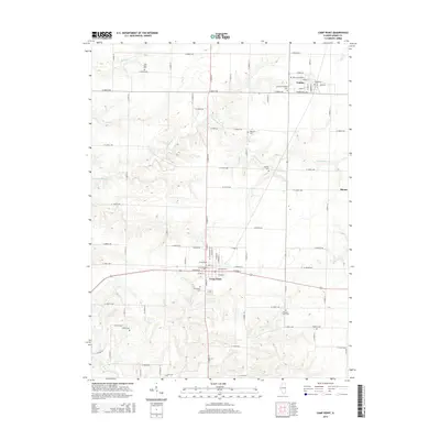
2015 Map of Camp Point
USGS Topo · Published 2015About this map
Camp Point and the smaller village of Golden anchor this agricultural landscape in eastern Adams County, where a grid of rural roads connects several notable nineteenth-century burying grounds. The terrain is defined by the drainage systems of S Fork Bear Cr and Elm Cr, which carve shallow valleys through the prairie. Genealogists will find a high density of rural cemeteries, including the Lutheran Friedhof Cem and York Neck Cem, suggesting the locations of early parish settlements and family homesteads. The small siding at Blacks and the rail-aligned streets of Golden, such as Prairie Mills Rd, highlight the importance of transportation routes to these farming communities. Waterways like Missouri Cr and Figley Br further illustrate the natural hydrology that influenced early settlement patterns across the quadrangle.
Find a feature on this map
84 named features on this map. Tap any name to fly to it.
Don’t see what you’re looking for? This feature index may not catch every label — zoom into the map to look around manually.
Map Details
Editions of this 2015 Camp Point Map
This is the sole edition of this map. No revisions or reprints were ever made.
Other maps of this area

1925 · Liberty
USGS Topo · 1:62,500

1926 · Mt Sterling
USGS Topo · 1:62,500

1927 · Liberty
USGS Topo · 1:62,500

1929 · Mt Sterling
USGS Topo · 1:62,500

1946 · Augusta
USGS Topo · 1:62,500

1948 · Quincy
USGS Topo · 1:250,000

1948 · Camp Point
USGS Topo · 1:62,500

1949 · Augusta
USGS Topo · 1:62,500

1956 · Quincy
USGS Topo · 1:250,000

1958 · Burlington
USGS Topo · 1:250,000