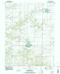
1994 Map of Camp Point
USGS Topo · Published 1998About this map
The village of Camp Point serves as a focal point in this 1990s landscape, illustrating the intersection of residential growth and regional utility infrastructure. The map details the local geography through numerous cemeteries such as Evergreen Cem and Yorkneck Cem, providing valuable touchpoints for family history researchers. Beyond the residential clusters, the terrain is defined by the drainage patterns of South Fork Bear Creek and Bigneck Creek, while local facilities like Bailey Park and Searls Field mark the community's recreational spaces.
Find a feature on this map
30 named features on this map. Tap any name to fly to it.
Don’t see what you’re looking for? This feature index may not catch every label — zoom into the map to look around manually.
Map Details
Editions of this 1994 Camp Point Map
This is the sole edition of this map. No revisions or reprints were ever made.
Other maps of this area

1925 · Liberty
USGS Topo · 1:62,500

1926 · Mt Sterling
USGS Topo · 1:62,500

1927 · Liberty
USGS Topo · 1:62,500

1929 · Mt Sterling
USGS Topo · 1:62,500

1946 · Augusta
USGS Topo · 1:62,500

1948 · Quincy
USGS Topo · 1:250,000

1948 · Camp Point
USGS Topo · 1:62,500

1949 · Augusta
USGS Topo · 1:62,500

1956 · Quincy
USGS Topo · 1:250,000

1958 · Burlington
USGS Topo · 1:250,000