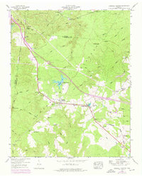
1946 Map of Campbell Junction
USGS Topo · Published 1976About this map
The Tennessee Valley Divide snakes across this portion of the Cumberland Plateau, separating waters that flow toward the Tennessee River from those bound for the Cumberland. Situated along the Louisville and Nashville rail corridor, the small settlements of Mayland and Campbell Junction serve as local hubs for the surrounding timber and agricultural lands. The landscape is characterized by prominent knobs and hollows, such as Verble Knobs and Walker Hollow, where isolated homesteads once relied on geographic landmarks like Funnel Rock and Dripping Springs.
Find a feature on this map
54 named features on this map. Tap any name to fly to it.
Don’t see what you’re looking for? This feature index may not catch every label — zoom into the map to look around manually.
Map Details
Editions of this 1946 Campbell Junction Map
3 editions found

Other maps of this area

1892 · Pikeville
USGS Topo · 1:125,000

1895 · Pikeville
USGS Topo · 1:125,000

1897 · Standingstone
USGS Topo · 1:125,000

1898 · Standingstone
USGS Topo · 1:125,000

1912 · Crossville
USGS Topo · 1:62,500

1935 · Isoline
USGS Topo · 1:24,000

1935 · Campbell Junction
USGS Topo · 1:24,000

1935 · Clarkrange
USGS Topo · 1:24,000
1936 · Crossville
USGS Topo · 1:24,000

1943 · Cookeville
USGS Topo · 1:100,000