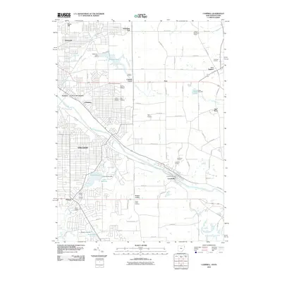
2010 Map of Campbell
USGS Topo · Published 2010About this map
The Mahoning River carves a deep industrial and transit corridor through this landscape, connecting the manufacturing hubs of Campbell and Struthers before winding toward Lowellville. This 2010 survey illustrates the dense residential and industrial footprint of the Youngstown vicinity, characterized by a complex network of roads like Poland Ave and Lowellville Rd that follow the river's path. To the north and east, the urban grid gives way to more open terrain near Coitsville Center and the Pennsylvania border. Significant water management features are evident throughout the quadrangle, including McKelvey Lake Dam and the Lake Hamilton Dam, which serve the region's historical industrial needs. Local history is anchored by numerous burial grounds, such as the Pioneer Methodist Cemetery and Evergreen Cemetery, providing vital touchpoints for genealogical research in this long-settled river valley.
Find a feature on this map
94 named features on this map. Tap any name to fly to it.
Don’t see what you’re looking for? This feature index may not catch every label — zoom into the map to look around manually.
Map Details
Editions of this 2010 Campbell Map
This is the sole edition of this map. No revisions or reprints were ever made.
Other maps of this area

1902 · New Castle
USGS Topo · 1:62,500

1904 · Newcastle
USGS Topo · 1:62,500

1905 · Neshannock
USGS Topo · 1:62,500

1906 · Youngstown
USGS Topo · 1:62,500

1907 · Neshannock
USGS Topo · 1:62,500

1907 · Columbiana
USGS Topo · 1:62,500

1908 · Youngstown
USGS Topo · 1:62,500

1909 · Columbiana
USGS Topo · 1:62,500

1950 · Cleveland
USGS Topo · 1:250,000

1951 · Canton
USGS Topo · 1:250,000