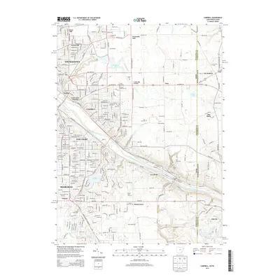
2013 Map of Campbell
USGS Topo · Published 2013About this map
The Mahoning River corridor serves as the industrial and topographic spine of this region, carving a path through the valley where Youngstown, Campbell, Struthers, and Lowellville developed. This 2013 survey illustrates the dense urban-industrial grid transitioning into the more open landscapes of Coitsville Center and Fitch. Water management is prominent, with McKelvey Lake, Lake Hamilton, and Burgess Lake providing substantial reservoirs amidst the hills. Genealogy interests are well-served by numerous recorded burial sites, including Poland Village Cem, Saint Nicholas Cem, and the Pioneer Methodist Cem. The map also details the Ohio-Pennsylvania state line, showing the eastern reach of the Mahoning County settlements as they meet Lawrence County at New Bedford and Villa Maria.
Find a feature on this map
59 named features on this map. Tap any name to fly to it.
Don’t see what you’re looking for? This feature index may not catch every label — zoom into the map to look around manually.
Map Details
Editions of this 2013 Campbell Map
This is the sole edition of this map. No revisions or reprints were ever made.
Other maps of this area

1902 · New Castle
USGS Topo · 1:62,500

1904 · Newcastle
USGS Topo · 1:62,500

1905 · Neshannock
USGS Topo · 1:62,500

1906 · Youngstown
USGS Topo · 1:62,500

1907 · Neshannock
USGS Topo · 1:62,500

1907 · Columbiana
USGS Topo · 1:62,500

1908 · Youngstown
USGS Topo · 1:62,500

1909 · Columbiana
USGS Topo · 1:62,500

1950 · Cleveland
USGS Topo · 1:250,000

1951 · Canton
USGS Topo · 1:250,000