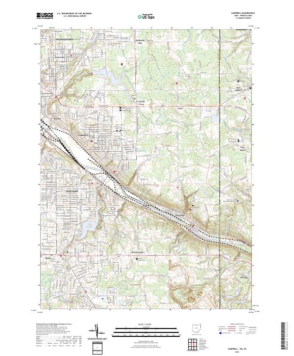
2023 Map of Campbell
USGS Topo · Published 2023About this map
The Mahoning River carves a deep industrial and historical corridor through this landscape, connecting the manufacturing hubs of Campbell, Struthers, and Lowellville. Along its banks, the dense residential grids of Youngstown and Scienceville give way to smaller settlements like Poland and Coitsville Center. The region's genealogy is preserved in numerous community burial grounds, including the Poland Village Cem and the Mahoning United Presbyterian Church Cem near the state line.
Find a feature on this map
187 named features on this map. Tap any name to fly to it.
Don’t see what you’re looking for? This feature index may not catch every label — zoom into the map to look around manually.
Map Details
Editions of this 2023 Campbell Map
This is the sole edition of this map. No revisions or reprints were ever made.
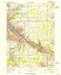
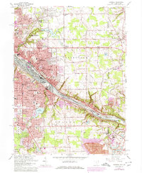
Historical Maps of Hazelton Through Time
3 maps found