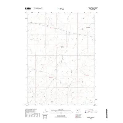
2018 Map of Campbell Ridge
USGS Topo · Published 2018About this map
Campbell Ridge dominates this high-altitude landscape in Fremont County, where drainage systems like Dry Cheyenne Cr and Oil Springs Cr carve through the arid terrain. The map captures a transition in Wyoming's land use, where traditional ranching infrastructure such as Poston Ranch Rd meets the industrial connectivity of Gas Hills Rd. Small, localized water features like Campbell Lake provide crucial points of reference in a region defined by its wide-open topography. Throughout the quadrangle, the network of unpaved routes, including the Jeep Pasture Trl and Oil Springs Rd, illustrates the necessity of rugged transit in accessing the various draws and creek beds that feed into larger systems like Conant Cr.
Find a feature on this map
16 named features on this map. Tap any name to fly to it.
Don’t see what you’re looking for? This feature index may not catch every label — zoom into the map to look around manually.
Map Details
Editions of this 2018 Campbell Ridge Map
This is the sole edition of this map. No revisions or reprints were ever made.
Other maps of this area

1951 · Fuller Reservoir
USGS Topo · 1:24,000

1951 · Indian Butte
USGS Topo · 1:24,000

1952 · Double Butte
USGS Topo · 1:24,000

1952 · Haybarn Hill
USGS Topo · 1:24,000

1952 · Rongis Reservoir
USGS Topo · 1:24,000

1953 · Blue Gulch
USGS Topo · 1:24,000

1953 · Campbell Ridge
USGS Topo · 1:24,000

1953 · Sand Draw
USGS Topo · 1:24,000

1955 · Thermopolis
USGS Topo · 1:250,000

1955 · Arminto
USGS Topo · 1:250,000