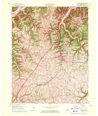
1969 Map of Campbellsburg
USGS Topo · Published 1972About this map
Campbellsburg serves as a central hub in this detailed 1969 revision, situated along the Louisville and Nashville railroad line that cuts through the undulating landscape of Henry County. The map captures a rural network of ridge-top roads and creek-bottom settlements, including Turners Station and Providence. The topography is defined by the winding course of the Little Kentucky River in the northwest and the East Fork to the east, with Gilgal Ridge providing a prominent elevation marker between drainage basins. Local history is etched into the landscape through family-named thoroughfares like Monfort Lane, Woodson Road, and Jones Lane, while spiritual centers like Hopewell Ch anchor the community. The transition of the era is evident in the presence of a Substation near the rail line, contrasting with older routes such as Coal Road and Station Road that follow the natural contours of the hills.
Find a feature on this map
28 named features on this map. Tap any name to fly to it.
Don’t see what you’re looking for? This feature index may not catch every label — zoom into the map to look around manually.
Map Details
Editions of this 1969 Campbellsburg Map
This is the sole edition of this map. No revisions or reprints were ever made.
Other maps of this area

1928 · New Castle
USGS Topo · 1:48,000

1932 · New Castle
USGS Topo · 1:62,500

1932 · La Grange
USGS Topo · 1:62,500

1943 · Brooksburg
USGS Topo · 1:24,000

1943 · Vevay South
USGS Topo · 1:24,000

1952 · Vevay South
USGS Topo · 1:24,000

1952 · Worthville
USGS Topo · 1:24,000

1952 · Campbellsburg
USGS Topo · 1:24,000

1953 · Bedford
USGS Topo · 1:24,000

1953 · Carrollton
USGS Topo · 1:24,000