
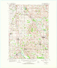
1955 Map of Campbellsport
USGS Topo · Published 1957About this map
The Milwaukee River and the East Branch Milwaukee River carve a complex path through this section of Fond du Lac County, defining a landscape where industrial extraction meets early rural settlement. Heavy limestone operations at Marblehead Quarries and Marblehead contrast with the wetland expanses of Wayne Marsh and McCullough Marsh further south. The map documents a significant network of mid-century rail infrastructure, including the Chicago and North Western and the Minneapolis St Paul and Sault Ste Marie, which connected agricultural hubs like Campbellsport, Lomira, and Eden to regional markets.
Find a feature on this map
80 named features on this map. Tap any name to fly to it.
Don’t see what you’re looking for? This feature index may not catch every label — zoom into the map to look around manually.
Map Details
Editions of this 1955 Campbellsport Map
2 editions found
Other maps of this area

1904 · West Bend
USGS Topo · 1:62,500

1904 · Hartford
USGS Topo · 1:62,500

1910 · Fond du Lac
USGS Topo · 1:62,500

1954 · Kiel
USGS Topo · 1:62,500

1955 · Waupun
USGS Topo · 1:62,500

1955 · Kewaskum
USGS Topo · 1:62,500

1955 · Fond Du Lac
USGS Topo · 1:62,500

1955 · Fond Du Lac
USGS Topo · 1:24,000

1955 · Horicon
USGS Topo · 1:62,500

1956 · Rosendale
USGS Topo · 1:62,500