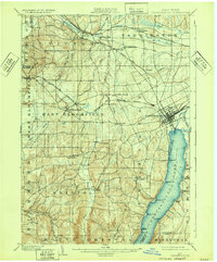
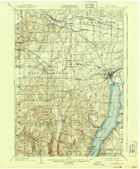
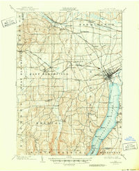
1903 Map of Canandaigua
USGS Topo · Published 1932About this map
Canandaigua Lake dominates this Finger Lakes landscape at the turn of the century, marked by an active Steamboat Route connecting points like Grange Landing and Gooding Landing. The region's transport network is exceptionally dense, showing the complex intersection of the Lehigh Valley R. R. and numerous branches of the New York Central system, including the Auburn Road and the Canandaigua Branch. This rail connectivity fueled a series of agricultural and shipping hubs such as Mertensia, Padelford, and Wheeler Station. Inland from the shoreline, the terrain rises into the Hopper Hills and Brier Hill, sheltering rural communities like Bristol Baptist Hill and Bristol Center. The map captures a moment before the widespread automotive era, when commerce still relied heavily on the proximity of the rail lines and lake-going vessels to move people and goods through Canandaigua and its neighboring townships.
Find a feature on this map
67 named features on this map. Tap any name to fly to it.
Don’t see what you’re looking for? This feature index may not catch every label — zoom into the map to look around manually.
Map Details
Editions of this 1903 Canandaigua Map
7 editions found

Other maps of this area

1895 · Rochester
USGS Topo · 1:62,500

1898 · Rochester
USGS Topo · 1:62,500

1899 · Palmyra
USGS Topo · 1:62,500

1900 · Macedon
USGS Topo · 1:62,500

1900 · Naples
USGS Topo · 1:62,500

1900 · Canandaigua
USGS Topo · 1:62,500

1901 · Honeoye
USGS Topo · 1:62,500

1902 · Phelps
USGS Topo · 1:62,500

1902 · Palmyra
USGS Topo · 1:62,500

1902 · Wayland
USGS Topo · 1:62,500