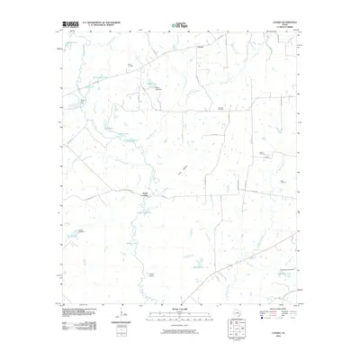
2010 Map of Canary
USGS Topo · Published 2010About this map
The Navasota River meanders through this portion of Madison County, defining a landscape of low-lying wetlands and oxbow lakes. Numerous water bodies such as San Antonio Lake, Mud Lake, and Wilson Lake flank the river's course, while the prominent Caney Island sits within the riparian corridor. This 2010 survey shows the rural character of the area, anchored by the settlement of Canary and the historic junction at Bundy Crossing. Family history is well-preserved through several burial sites scattered across the landscape, including Burns Cemetery, Plainview Cemetery, and Nash Cemetery. Transportation is defined by a grid of rural routes and the diagonal track of the OSR Hwy, providing access to the various dams and creek crossings that manage the local hydrology. The map illustrates a quiet agricultural region where names like Wager Lake and Stillwagon Lake point to local land use and development.
Find a feature on this map
57 named features on this map. Tap any name to fly to it.
Don’t see what you’re looking for? This feature index may not catch every label — zoom into the map to look around manually.
Map Details
Editions of this 2010 Canary Map
This is the sole edition of this map. No revisions or reprints were ever made.
Other maps of this area

1925 · Iola No 2
USGS Topo · 1:48,000

1925 · Marquez No. 4
USGS Topo · 1:48,000

1927 · Marquez
USGS Topo · 1:62,500

1930 · Marquez
USGS Topo · 1:62,500

1931 · Iola
USGS Topo · 1:62,500

1954 · Waco
USGS Topo · 1:250,000

1954 · Austin
USGS Topo · 1:250,000

1955 · Waco
USGS Topo · 1:250,000

1959 · Clear Lake
USGS Topo · 1:24,000

1962 · Edge
USGS Topo · 1:24,000