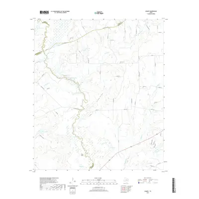
2019 Map of Canary
USGS Topo · Published 2019About this map
The Navasota River valley forms the centerpiece of this Texas landscape, marking the complex intersection where Madison, Leon, Robertson, and Brazos counties meet. This river system creates a vast network of wetlands and oxbow lakes, including San Antonio Lake, Donahoe Lake, and Wilson Lake, which dominate the central corridor. Historical transport routes define the upland geography, notably the OSR Hwy and the Old San Antonio Rd, which trace the higher ground above the river bottomlands. This 2019 survey documents the small community of Canary and preserves the locations of numerous rural burial grounds such as Burns Cem, Plainview Cem, and Nash Cem. The detailed hydrography of the Big Slough and Caney Island illustrates how the river's shifting path has shaped the topography and settlement patterns of this cattle-and-timber region over generations.
Find a feature on this map
73 named features on this map. Tap any name to fly to it.
Don’t see what you’re looking for? This feature index may not catch every label — zoom into the map to look around manually.
Map Details
Editions of this 2019 Canary Map
This is the sole edition of this map. No revisions or reprints were ever made.
Other maps of this area

1925 · Iola No 2
USGS Topo · 1:48,000

1925 · Marquez No. 4
USGS Topo · 1:48,000

1927 · Marquez
USGS Topo · 1:62,500

1930 · Marquez
USGS Topo · 1:62,500

1931 · Iola
USGS Topo · 1:62,500

1954 · Waco
USGS Topo · 1:250,000

1954 · Austin
USGS Topo · 1:250,000

1955 · Waco
USGS Topo · 1:250,000

1959 · Clear Lake
USGS Topo · 1:24,000

1962 · Edge
USGS Topo · 1:24,000