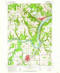
1961 Map of Canby
USGS Topo · Published 1962About this map
The Willamette River snakes through the heart of this landscape, marking the confluence of several major waterways including the Tualatin River, Molalla River, and Pudding River. In the early 1960s, the growing hubs of Canby and West Linn anchor the region, connected by the Southern Pacific railroad and a network of rural roads like Wilsonville Road and Territorial Road. The map reveals a transition from industrial activity near the river—noted by Pulp and Sewage Disposal sites—to the agricultural research grounds of the Oregon State Univ Experimental Sta. Smaller historic pockets remain visible through family and community landmarks such as Robert Bird Cemetery, Stafford, and New Era. This document captures the mid-century character of Clackamas County as rural homesteads and early orchards began to give way to suburban development.
Find a feature on this map
72 named features on this map. Tap any name to fly to it.
Don’t see what you’re looking for? This feature index may not catch every label — zoom into the map to look around manually.
Map Details
Editions of this 1961 Canby Map
4 editions found
Other maps of this area

1914 · Oregon City
USGS Topo · 1:62,500

1916 · Tualatin
USGS Topo · 1:62,500

1923 · Mount Angel
USGS Topo · 1:62,500

1939 · Molalla
USGS Topo · 1:62,500

1939 · Oregon City
USGS Topo · 1:62,500

1939 · Tualatin
USGS Topo · 1:62,500

1940 · Tualatin
USGS Topo · 1:62,500

1940 · Molalla
USGS Topo · 1:62,500

1940 · Mount Angel
USGS Topo · 1:62,500

1941 · Oregon City
USGS Topo · 1:62,500