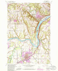
1961 Map of Canby
USGS Topo · Published 1985About this map
Petes Mountain dominates the center of this landscape, its steep slopes descending toward the wide sweep of the Willamette River. This 1961 document, updated in the mid-1980s, captures a riverside community defined by its waterways and transport links, from the Canby Ferry still operating north of Canby to the Southern Pacific tracks running through Barlow. The map reveals a dense network of early local landmarks, including the Grange Hall near Advance and several historic burial grounds such as the Robert Bird Cemetery and Zoar Cem.
Find a feature on this map
55 named features on this map. Tap any name to fly to it.
Don’t see what you’re looking for? This feature index may not catch every label — zoom into the map to look around manually.
Map Details
Editions of this 1961 Canby Map
4 editions found
Other maps of this area

1914 · Oregon City
USGS Topo · 1:62,500

1916 · Tualatin
USGS Topo · 1:62,500

1923 · Mount Angel
USGS Topo · 1:62,500

1939 · Molalla
USGS Topo · 1:62,500

1939 · Oregon City
USGS Topo · 1:62,500

1939 · Tualatin
USGS Topo · 1:62,500

1940 · Tualatin
USGS Topo · 1:62,500

1940 · Molalla
USGS Topo · 1:62,500

1940 · Mount Angel
USGS Topo · 1:62,500

1941 · Oregon City
USGS Topo · 1:62,500