
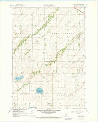
1967 Map of Canby SE
USGS Topo · Published 1969About this map
Glacial geology and agricultural development meet in this late 1960s survey of Lincoln County, Minnesota. The landscape is defined by the headwaters of two major river systems: the Lac qui Parle River flowing through the northern townships and the Yellow Medicine River, including its North Branch, winding through the south. This era shows a significant emphasis on conservation and land management, with numerous designated zones such as the Dorer State Wildlife Management Area and the Johnson State Wildlife Management Area protecting the prairie wetlands.
Find a feature on this map
25 named features on this map. Tap any name to fly to it.
Don’t see what you’re looking for? This feature index may not catch every label — zoom into the map to look around manually.
Map Details
Editions of this 1967 Canby SE Map
This is the sole edition of this map. No revisions or reprints were ever made.
Other maps of this area

1953 · Watertown
USGS Topo · 1:250,000

1958 · Watertown
USGS Topo · 1:250,000

1963 · Arco
USGS Topo · 1:24,000

1967 · Canby
USGS Topo · 1:24,000

1967 · Canby NW
USGS Topo · 1:24,000

1967 · Porter
USGS Topo · 1:24,000
1967 · Porter SW
USGS Topo · 1:24,000

1967 · Lake Benton NW
USGS Topo · 1:24,000

1967 · Hendricks
USGS Topo · 1:24,000

1967 · Lake Benton NE
USGS Topo · 1:24,000