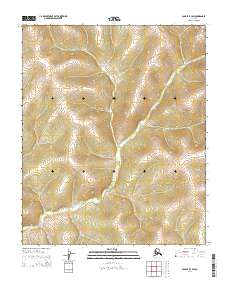
2014 Map of Candle B-3 SW
USGS Topo · Published 2014About this map
The E Fork Koyuk River winds through this interior landscape near Nome, creating a primary drainage pattern that dictates the topography of the surrounding hills. This 2014 survey captures a remote section of the Alaskan wilderness where human intervention is minimal, marked primarily by the presence of the Tipuktuliuraq Route in the southwestern corner. The terrain is defined by significant elevation changes, with ridges rising sharply from the river valley. The map is organized by the Public Land Survey System, showing the intersections of several townships including t2s r9w and t2s r8w, which provide a structural grid over the seemingly untouched wilderness. This document is a clear record of the hydrography and high-altitude trails used to navigate the Seward Peninsula hinterlands in the early 21st century.
Find a feature on this map
8 named features on this map. Tap any name to fly to it.
Don’t see what you’re looking for? This feature index may not catch every label — zoom into the map to look around manually.
Map Details
Editions of this 2014 Candle B-3 SW Map
This is the sole edition of this map. No revisions or reprints were ever made.
Other maps of this area

1951 · Candle
USGS Topo · 1:250,000

1955 · Candle
USGS Topo · 1:250,000
1955 · Candle A-4
USGS Topo · 1:63,360

1955 · Candle B-3
USGS Topo · 1:63,360
1955 · Candle B-4
USGS Topo · 1:63,360

1964 · Candle
USGS Topo · 1:250,000
2014 · Candle B-3 NW
USGS Topo · 1:25,000
2014 · Candle A-3 NE
USGS Topo · 1:25,000
2014 · Candle A-4 NE
USGS Topo · 1:25,000
2014 · Candle A-3 NW
USGS Topo · 1:25,000