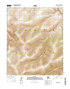
2014 Map of Candle C-3 SE
USGS Topo · Published 2014About this map
Little Kalusuk Cr meanders through the central and eastern portions of this Northwest Arctic landscape, serving as the primary drainage feature for the surrounding terrain. The hydrology is further defined by Ulukluk Cr, which cuts through the northwestern corner. This 2014 survey focuses on a remote section of the Alaska interior, where the land is organized according to the Public Land Survey System across multiple townships, including t2n r7w and t1n r7w. The map illustrates a transitional subarctic environment where elevation changes are captured in fine detail, revealing the drainage patterns that feed into these Arctic waterways.
Find a feature on this map
10 named features on this map. Tap any name to fly to it.
Don’t see what you’re looking for? This feature index may not catch every label — zoom into the map to look around manually.
Map Details
Editions of this 2014 Candle C-3 SE Map
This is the sole edition of this map. No revisions or reprints were ever made.
Other maps of this area

1951 · Candle
USGS Topo · 1:250,000

1954 · Candle C-2
USGS Topo · 1:63,360

1954 · Candle B-2
USGS Topo · 1:63,360

1955 · Candle
USGS Topo · 1:250,000

1955 · Candle B-3
USGS Topo · 1:63,360

1955 · Candle C-3
USGS Topo · 1:63,360

1964 · Candle
USGS Topo · 1:250,000
2014 · Candle C-3 NE
USGS Topo · 1:25,000
2014 · Candle C-3 NW
USGS Topo · 1:25,000
2014 · Candle C-3 SW
USGS Topo · 1:25,000