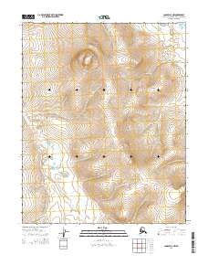
2014 Map of Candle D-5 NW
USGS Topo · Published 2014About this map
Clem Mountain anchors the northern reaches of this landscape in the Northwest Arctic Borough, rising above the surrounding terrain in the T7N R13W township. The drainage patterns of the region are defined by Duck Cr and Kanik Cr, which flow through the tundra-like environment as it appeared in the early 21st century. Human impact on the land is sparse but specific, noted primarily by the Landfill Access road in the northeastern corner of the quadrangle. This 2014 survey documents the area's topographic character with 20-foot contour intervals, capturing the subtle elevations and hydrographic features of the Alaskan wilderness before more recent environmental shifts. The map provides a clear look at the public land survey system grid, including townships t6n r13w and t7n r12w, which are essential for locating specific land parcels and historical claims.
Find a feature on this map
8 named features on this map. Tap any name to fly to it.
Don’t see what you’re looking for? This feature index may not catch every label — zoom into the map to look around manually.
Map Details
Editions of this 2014 Candle D-5 NW Map
This is the sole edition of this map. No revisions or reprints were ever made.
Other maps of this area

1951 · Candle
USGS Topo · 1:250,000

1951 · Selawik
USGS Topo · 1:250,000

1951 · Candle D-5
USGS Topo · 1:63,360

1951 · Selawik A-5
USGS Topo · 1:63,360

1951 · Candle D-6
USGS Topo · 1:63,360

1951 · Selawik A-6
USGS Topo · 1:63,360

1955 · Candle
USGS Topo · 1:250,000

1957 · Selawik
USGS Topo · 1:250,000

1964 · Candle
USGS Topo · 1:250,000
2014 · Selawik A-5 SW
USGS Topo · 1:25,000