
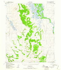
1951 Map of Candle D-5
USGS Topo · Published 1957About this map
Buckland and the winding Buckland River anchor this mid-century topographic study of the Alaska landscape. The terrain is defined by prominent elevations such as Clem Mountain and Sugar Top, which rise above a network of waterways including Kanik Creek, Koobuk Creek, and Duck Creek. A lone Cabin and a designated Tractor Trail in the southwest quadrant suggest the sparse but essential infrastructure of the era, likely supporting local subsistence or early resource exploration. The drainage patterns are intricate, with Fairhaven Creek and the Left Fork of Hunter Creek cutting through the contours. This survey, mapped by the Army Map Service and published by the Geological Survey, captures the area before modern developments, providing a clear record of the region's hydrography and landforms during a period of transition in the Alaskan interior.
Find a feature on this map
13 named features on this map. Tap any name to fly to it.
Don’t see what you’re looking for? This feature index may not catch every label — zoom into the map to look around manually.
Map Details
Editions of this 1951 Candle D-5 Map
3 editions found
Other maps of this area

1950 · Candle C-5
USGS Topo · 1:63,360

1950 · Candle C-6
USGS Topo · 1:63,360

1951 · Candle
USGS Topo · 1:250,000

1951 · Selawik
USGS Topo · 1:250,000

1951 · Selawik A-5
USGS Topo · 1:63,360

1951 · Candle D-6
USGS Topo · 1:63,360

1951 · Selawik A-6
USGS Topo · 1:63,360

1955 · Candle
USGS Topo · 1:250,000

1955 · Selawik A-4
USGS Topo · 1:63,360

1955 · Candle D-4
USGS Topo · 1:63,360