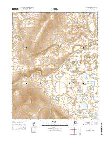
2014 Map of Selawik A-5 SW
USGS Topo · Published 2014About this map
Duck Cr winds through the expansive lowlands of the Arctic Northwest, serving as a primary drainage feature for this remote Alaskan landscape. This 2014 survey captures a terrain defined by subtle elevation changes and complex hydrology, where numerous small ponds and seasonal wetlands collect at the base of the surrounding ridges. The grid-based surveying of the Public Land Survey System is marked by township and range lines including t8n r13w, t8n r12w, t7n r13w, and t7n r12w. These designations provide a critical reference for land management and ecological study in a region otherwise devoid of permanent human settlements or infrastructure, illustrating the vast, unfragmented character of the northern interior near the Arctic Circle.
Find a feature on this map
5 named features on this map. Tap any name to fly to it.
Don’t see what you’re looking for? This feature index may not catch every label — zoom into the map to look around manually.
Map Details
Editions of this 2014 Selawik A-5 SW Map
This is the sole edition of this map. No revisions or reprints were ever made.
Other maps of this area

1951 · Candle
USGS Topo · 1:250,000

1951 · Selawik
USGS Topo · 1:250,000

1951 · Candle D-5
USGS Topo · 1:63,360

1951 · Selawik A-5
USGS Topo · 1:63,360

1951 · Candle D-6
USGS Topo · 1:63,360

1951 · Selawik A-6
USGS Topo · 1:63,360

1955 · Candle
USGS Topo · 1:250,000

1957 · Selawik
USGS Topo · 1:250,000

1964 · Candle
USGS Topo · 1:250,000
2014 · Selawik A-5 NE
USGS Topo · 1:25,000