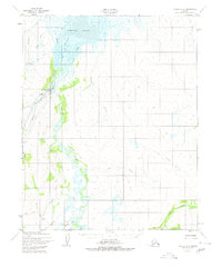
1951 Map of Candle D-6
USGS Topo · Published 1980About this map
Candle stands as the primary hub of activity in this remote region of the Seward Peninsula, appearing here as it was surveyed in the mid-twentieth century. The landscape is defined by the winding Kiwalik River and the complex drainage of the Kiwalik Lagoon, where numerous channels like the North Channel and Middle Channel meet the tide. This map documents a specialized extractive landscape, evidenced by Mine Tailings and the extensive Mud Ditch and Candle Ditch systems, which suggest the scale of hydraulic mining operations in the area.
Find a feature on this map
37 named features on this map. Tap any name to fly to it.
Don’t see what you’re looking for? This feature index may not catch every label — zoom into the map to look around manually.
Map Details
Editions of this 1951 Candle D-6 Map
3 editions found

Other maps of this area

1950 · Kotzebue A-1
USGS Topo · 1:63,360

1950 · Bendeleben C-1
USGS Topo · 1:63,360

1950 · Bendeleben
USGS Topo · 1:250,000

1950 · Candle C-5
USGS Topo · 1:63,360

1950 · Bendeleben D-1
USGS Topo · 1:63,360

1950 · Candle C-6
USGS Topo · 1:63,360

1951 · Candle
USGS Topo · 1:250,000

1951 · Selawik
USGS Topo · 1:250,000

1951 · Bendeleben
USGS Topo · 1:250,000

1951 · Kotzebue
USGS Topo · 1:250,000