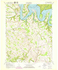
1970 Map of Cane Valley
USGS Topo · Published 1979About this map
Green River Lake dominates the northern reaches of this Adair County landscape, where the waters back into Butler Creek and Sandy Creek. The terrain is characterized by the winding path of the Green River as it snakes through Lemon Bend and Hibbs Bend, eventually meeting the impounded lake. This 1970s revision captures the area's rural transition, marking the locations of long-standing family landmarks and religious centers such as Cane Valley Ch, Mt Pleasant Ch, and Charity Ch.
Find a feature on this map
53 named features on this map. Tap any name to fly to it.
Don’t see what you’re looking for? This feature index may not catch every label — zoom into the map to look around manually.
Map Details
Editions of this 1970 Cane Valley Map
4 editions found
Other maps of this area

1952 · Mannsville
USGS Topo · 1:24,000

1953 · Gradyville
USGS Topo · 1:24,000

1953 · Campbellsville
USGS Topo · 1:24,000

1953 · Montpelier
USGS Topo · 1:24,000

1953 · Gresham
USGS Topo · 1:24,000

1953 · Cane Valley
USGS Topo · 1:24,000

1954 · Knifley
USGS Topo · 1:24,000

1954 · Columbia
USGS Topo · 1:24,000

1954 · Greensburg
USGS Topo · 1:24,000

1957 · Winchester
USGS Topo · 1:250,000