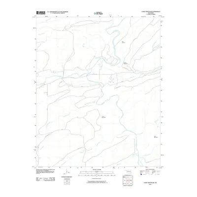
2010 Map of Caney Mountain
USGS Topo · Published 2010About this map
Caney Mountain and Wolf Mountain anchor this landscape in Pushmataha County, where the Little River carves a winding path through deep Oklahoma timberland. The map reveals a network of specialized routes and tracks, including the Caney Creek Trl and Baggs Trl, which navigate the elevation changes around Bear Canyon and the sharp ridge of the Devils Backbone. While primarily a study of topography and drainage, the presence of Iron Springs suggests a historical focal point for those traveling these hills. The area is defined by its complex hydrology, with numerous tributaries such as Cloudy Creek, Rock Pen Creek, and Rain Creek feeding into the main river system. Small secondary roads like Cloudy Rd and Holly Creek Rd provide the primary access to these more isolated reaches of the Ouachita region.
Find a feature on this map
27 named features on this map. Tap any name to fly to it.
Don’t see what you’re looking for? This feature index may not catch every label — zoom into the map to look around manually.
Map Details
Editions of this 2010 Caney Mountain Map
This is the sole edition of this map. No revisions or reprints were ever made.
Other maps of this area

1901 · Alikchi
USGS Topo · 1:125,000

1950 · Mcalester
USGS Topo · 1:250,000

1962 · McAlester
USGS Topo · 1:250,000

1962 · Sobol
USGS Topo · 1:24,000

1962 · Caney Mountain
USGS Topo · 1:24,000

1962 · Alikchi
USGS Topo · 1:24,000

1962 · Signal Mountain
USGS Topo · 1:24,000

1965 · McAlester
USGS Topo · 1:250,000

1971 · Spencerville
USGS Topo · 1:24,000
1972 · Clebit
USGS Topo · 1:24,000