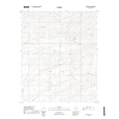
2019 Map of Caney Mountain
USGS Topo · Published 2019About this map
Little River winds through this section of Pushmataha County, carving a deep path between the prominent peaks of Caney Mtn and Wolf Mtn. This Oklahoma landscape is defined by its ridge-and-valley formation, featuring significant landmarks such as Devils Backbone and the secluded Iron Springs near the river bend. The drainage network is complex, with numerous tributaries including Cloudy Creek, Rock Pen Cr, and Houston Cr feeding into the main river channel.
Find a feature on this map
36 named features on this map. Tap any name to fly to it.
Don’t see what you’re looking for? This feature index may not catch every label — zoom into the map to look around manually.
Map Details
Editions of this 2019 Caney Mountain Map
This is the sole edition of this map. No revisions or reprints were ever made.
Other maps of this area

1901 · Alikchi
USGS Topo · 1:125,000

1950 · Mcalester
USGS Topo · 1:250,000

1962 · McAlester
USGS Topo · 1:250,000

1962 · Sobol
USGS Topo · 1:24,000

1962 · Caney Mountain
USGS Topo · 1:24,000

1962 · Alikchi
USGS Topo · 1:24,000

1962 · Signal Mountain
USGS Topo · 1:24,000

1965 · McAlester
USGS Topo · 1:250,000

1971 · Spencerville
USGS Topo · 1:24,000
1972 · Clebit
USGS Topo · 1:24,000