
1964 Map of Canistota
USGS Topo · Published 1966About this map
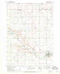
The town of Canistota serves as a hub for the agricultural plains of eastern South Dakota in the mid-1960s, situated along the Chicago And North Western railroad line. The surrounding landscape is defined by the meandering path of the West Fork Vermillion River, which cuts through the southern half of the quadrangle. This era shows a rural township structure still heavily supported by a network of local institutions, including several numbered schoolhouses like School No 1 and School No 4, and the Cameron Sch to the west.
Find a feature on this map
18 named features on this map. Tap any name to fly to it.
Don’t see what you’re looking for? This feature index may not catch every label — zoom into the map to look around manually.
Map Details
Editions of this 1964 Canistota Map
This is the sole edition of this map. No revisions or reprints were ever made.
Other maps of this area

1898 · Parker
USGS Topo · 1:125,000

1955 · Sioux Falls
USGS Topo · 1:250,000

1958 · Sioux Falls
USGS Topo · 1:250,000

1964 · Montrose
USGS Topo · 1:24,000

1964 · Salem NE
USGS Topo · 1:24,000

1964 · Salem
USGS Topo · 1:24,000

1964 · Bridgewater East
USGS Topo · 1:24,000

1964 · East Vermillion Lake
USGS Topo · 1:24,000
1968 · Parker
USGS Topo · 1:24,000
1970 · Marion
USGS Topo · 1:24,000