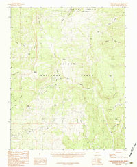
1983 Map of Canjilon Mountain
USGS Topo · Published 1983About this map
Carson National Forest encompasses the high-altitude terrain shown in this 1983 edition, centered on the prominent peak of Canjilon Mountain. The landscape is defined by its complex network of water sources and canyons, with the Tierra Amarilla Grant Boundary marking the northern reaches of the survey. Significant water features including Trout Lakes, Blue Lake, and Laguna Honda dot the drainages, while numerous named springs such as Ojito Azul, Canovas Spring, and Alkali Spring indicate a terrain where water management and access were critical to land use.
Find a feature on this map
32 named features on this map. Tap any name to fly to it.
Don’t see what you’re looking for? This feature index may not catch every label — zoom into the map to look around manually.
Map Details
Editions of this 1983 Canjilon Mountain Map
2 editions found
Other maps of this area

1918 · Abiquiu
USGS Topo · 1:125,000

1918 · Tusas
USGS Topo · 1:125,000

1953 · Valle Grande Peak
USGS Topo · 1:24,000

1953 · Magote Peak
USGS Topo · 1:24,000

1953 · Canjilon
USGS Topo · 1:24,000

1954 · Aztec
USGS Topo · 1:250,000

1955 · Cebolla
USGS Topo · 1:62,500

1958 · Aztec
USGS Topo · 1:250,000

1962 · Aztec
USGS Topo · 1:250,000

1963 · Burned Mountain
USGS Topo · 1:24,000