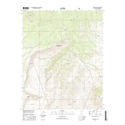
2017 Map of Canjilon SE
USGS Topo · Published 2017About this map
Carson National Forest encompasses the majority of this high-elevation terrain, defined by a complex network of arroyos and canyons that dictate the movement of water and travelers alike. The small settlement of El Puertecito sits at the southwestern edge of the quadrangle, serving as a rare point of habitation amidst the drainage systems of Arroyo del Cobre and Arroyo del Chamiso. These ephemeral waterways carve deep through the landscape, creating notable landforms such as Cañon de Cobre and Comanche Canyon. The importance of water management in this arid environment is evident through named features like Pine Canyon Tank and Madera Tank, alongside numerous natural springs known as ojitos. To the south, the prominent Sierra Negra and Cerrito de la Ventana rise above the drainage of Arroyo del Cerrito Negro, marking the transition between forested heights and the lower canyon floors.
Find a feature on this map
31 named features on this map. Tap any name to fly to it.
Don’t see what you’re looking for? This feature index may not catch every label — zoom into the map to look around manually.
Map Details
Editions of this 2017 Canjilon SE Map
This is the sole edition of this map. No revisions or reprints were ever made.
Other maps of this area

1918 · Abiquiu
USGS Topo · 1:125,000

1953 · Canones
USGS Topo · 1:24,000

1953 · Abiquiu
USGS Topo · 1:24,000

1953 · Medanales
USGS Topo · 1:24,000

1953 · Valle Grande Peak
USGS Topo · 1:24,000

1953 · Magote Peak
USGS Topo · 1:24,000

1953 · Canjilon
USGS Topo · 1:24,000

1953 · El Rito
USGS Topo · 1:24,000

1953 · Canjilon SE
USGS Topo · 1:24,000

1953 · Ghost Ranch
USGS Topo · 1:24,000