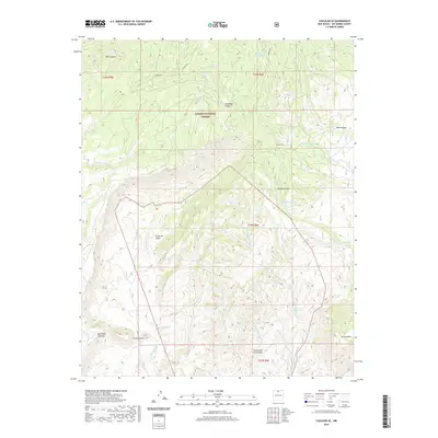
2020 Map of Canjilon SE
USGS Topo · Published 2020About this map
Carson National Forest defines the high-desert and mountainous landscape of this Northern New Mexico quadrangle. The terrain is a complex network of seasonal drainage systems, including Arroyo del Chamiso, Arroyo de Soldados, and Arroyo Hondo, which carve through prominent landforms like Cerrito de la Ventana and the Sierra Negra. Water sources are vital markers in this arid environment, recorded here as traditional "ojitos" and livestock tanks, such as Ojito del Comanche, Ojito Carrizo, and the Madera Tank. Small settlements and named locales like El Puertecito and Madera-Cañon are situated near these geographic corridors. Significant depressions and canyons, notably Cañon de Cobre and Comanche Canyon, reveal a history of resource use and movement through these canyons in Rio Arriba County.
Find a feature on this map
26 named features on this map. Tap any name to fly to it.
Don’t see what you’re looking for? This feature index may not catch every label — zoom into the map to look around manually.
Map Details
Editions of this 2020 Canjilon SE Map
This is the sole edition of this map. No revisions or reprints were ever made.
Other maps of this area

1918 · Abiquiu
USGS Topo · 1:125,000

1953 · Canones
USGS Topo · 1:24,000

1953 · Abiquiu
USGS Topo · 1:24,000

1953 · Medanales
USGS Topo · 1:24,000

1953 · Valle Grande Peak
USGS Topo · 1:24,000

1953 · Magote Peak
USGS Topo · 1:24,000

1953 · Canjilon
USGS Topo · 1:24,000

1953 · El Rito
USGS Topo · 1:24,000

1953 · Canjilon SE
USGS Topo · 1:24,000

1953 · Ghost Ranch
USGS Topo · 1:24,000